Mineral County
Community Description & Overview
Mineral County spans an area of 3,813 square miles, over 80% of which is federally managed. Hawthorne is the county seat. The 2014 United States Census Bureau estimated Mineral County to have a population of roughly 4,500 with the majority of the population dispersed throughout the towns of Hawthorne (3,269), Schurz (Walker River Paiute Indian Reservation) (658), Walker Lake (275) , Mina (155), and Luning (98).
Mineral County is located in west-central Nevada and is adjacent to Mount Grant and the Wassuk, Gillis, Gabbs Valley, Pilot Mountains, Excelsior and White Mountain ranges.
Mineral County was officially created in 1911. The county was aptly named for the discovery of gold in the town of Aurora in 1860. Mining of gold, silver, copper, mercury, and iron are just a few of the minerals that have been mined from Mineral County.
The U.S. Ammunition Depot (Hawthorne Army Depot) is the largest industrial proponent of the county. The Hawthorne Army Depot was established in September of 1930. Since then it has had numerous name changes. The facility’s original purpose was to receive, store, maintain, renovate, and issue ammunition, explosives, and other ordnance weapons. The site currently serves as a storage facility and holds training exercises for Reserve Marines.
Many residents and tourists love Mineral County for the abundant recreational activities made available such as hiking, fishing, boating, horseback riding, and ghost town exploration. Walker Lake offers many recreation opportunities to residents and visitors year-round. Hawthorne is also home to the Hawthorne Ordnance Museum and the 1942 USO Building.
With the exception of two small areas (northern and southeastern), Mineral County is supplied electrical energy from NV Energy.
Renewable Energy Factors
Mineral County contains an ample supply of renewable energy resources, including biomass, geothermal, and solar resources. Mineral County has the potential, due to its geographic proximity, to transmit power across state lines to the California system.
The RDSBC Mineral County, NV Renewable Energy Resources map (right) shows solar resources for Concentrating Solar Power (CSP) and tilted Photovoltaic (PV), favorability for Geothermal Potential, annual average Wind Resource at 50-meter height above ground surface, Pinyon-Juniper Woodland as a Biomass energy source, and transmission lines and substations for capacities 230 kV or greater.
CLICK here or on the map image to view or download the 34″ x 44″ PDF version of the map. Please note: the file is large and may take a while to display.

Biomass
Mineral County has potential biomass resource utilization in the form of Pinyon-juniper forests, which can be harvested and used directly as a heat source when burned or used for commercial purposes.
Geothermal
The Don A. Campbell geothermal power plant, located 20 miles west of Gabbs, Nevada, went online at the end of 2013. Ormat Technologies, Inc. made a 20-year Power Purchase Agreement (PPA) with Southern California Public Power Authority (SCPPA). Ormat will sell the power to SCPPA, using the One Nevada Transmission Line, at a rate of $99 per megawatt hour. Mineral County has favorable resources for geothermal development, as shown by the Don A. Campbell facility, and has the potential to provide Mineral County with economic development opportunities, and to provide clean energy to Nevada and California.
Solar
A solar field known as the “Luning Solar Energy Center” has been proposed for construction on 560 acres of public land on the Luning Flats. Invenergy Solar Development, LLC (Invenergy) has submitted an application to the Bureau of Land Management (BLM) to construct the utility-scale photovoltaic (PV) solar project. The solar plant would have a generating capacity of up to 50 megawatts (MW) peak capacity and create up to 100 construction jobs. The project will supply $1 million annually to the local economy.
Mineral County Utility Table
CLICK HERE for a PDF version of a table summarizing Mineral County Load Service Utility Information for the load serving utility in Mineral County: NV Energy
RDSBC Brownfields Properties
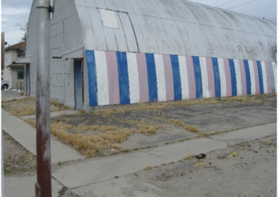
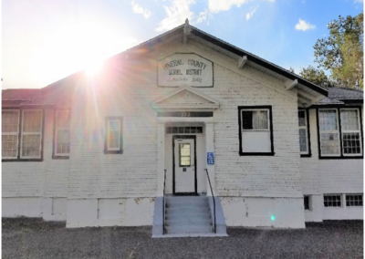
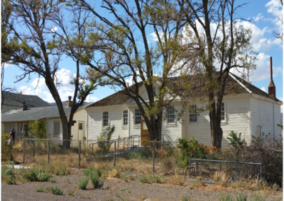
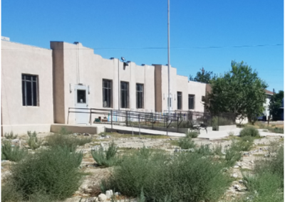
Under the RDSBC project, five parcels were assessed in Mineral County. The assessed properties included: one parcel at the Cinema Building, one parcel at the ISOM Property, one parcel at the Mineral County School District Administrative Building, one parcel at the Mina School, and one parcel at the Sixth Street School.